
Draw the map, then build
Gameplay
Oct 4
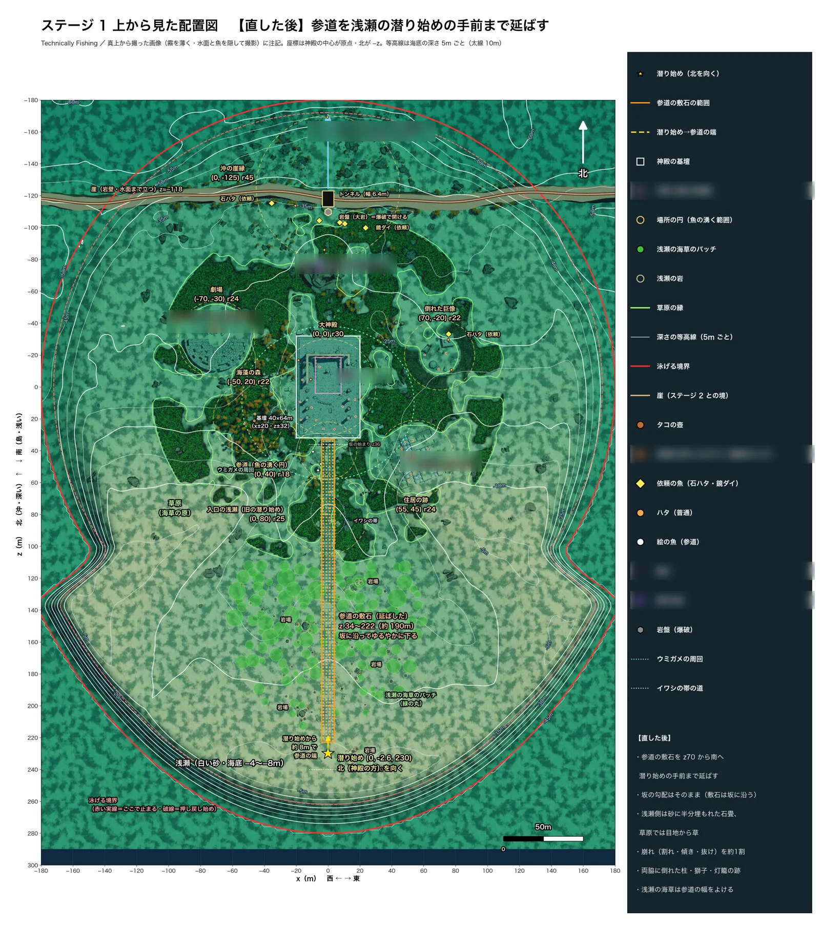
The Stage 1 map had been drawn once on Sep 19 and never updated. After that, moving the dive start further south and widening the terrain were done just by editing numbers. As a result, you could swim straight out from the shallows and never reach the temple approach.
So on Oct 4 I made a layout map of the stage, shot from directly above, marked with 5 m contour lines, the swimmable boundary, place names, and even where the fish and pots are. Working from it, I extended the temple approach by about 200 m to just in front of the dive start, as a gently descending slope.
Oct 7
The currents added on Oct 7 also had their locations decided on the Stage 1 layout map.